
Pakistan's Giant Eye In The Sky: How SUPARCO's New Satellite Is Protecting Farmers And Predicting Floods <i class="fas fa-satellite"></i>

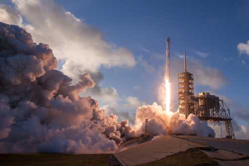
Imagine you are standing in your backyard, looking up at the night sky. You see millions of tiny, twinkling stars. But among those stars, there is something else moving very, very fast. It is not a star, and it is not a bird. It is a giant, magical camera made of metal and wires, floating in the cold, dark emptiness of space. This magical camera belongs to Pakistan, and its job is to watch over the country, day and night, to keep everyone safe. This incredible machine is the latest Earth observation satellite launched by SUPARCO, the Space and Upper Atmosphere Research Commission. In the summer of 2026, this satellite has become the most important tool in Pakistan's history for fighting climate change, helping farmers grow more food, and predicting dangerous floods before they even happen.
The Big Launch
After years of hard work, designing, and testing, Pakistan successfully placed this advanced remote-sensing satellite into its perfect orbit. The launch was a moment of immense national pride, watched by millions of citizens who understand that this tiny machine in the sky holds the key to securing the country's agricultural and environmental future.
What Exactly Is A Satellite?
To understand why this is such a massive deal, we first need to understand what a satellite actually is. Think about when you throw a ball really, really hard. If you throw it fast enough, instead of falling back to the ground, it just keeps missing the ground because the Earth is round and curves away beneath it. That is what a satellite is: a machine thrown into space at such an incredible speed that it falls around the Earth forever, never crashing down.
But this is not just any machine. It is packed with super-sensitive cameras and scanners. While you are sleeping in your bed, this satellite is zooming over Pakistan at thousands of miles per hour, taking pictures of the mountains in the north, the deserts in the south, the rivers in the middle, and the bustling cities. It takes pictures not just with normal light, but with special "invisible" light that human eyes cannot see. This allows it to see things that are hidden, like dry soil under a layer of dust, or sick plants in a massive farm.
The Magic Helper For Our Farmers
Pakistan is a country that loves its land. Agriculture is the backbone of the nation. Millions of farmers wake up before the sun rises to work in the fields, growing wheat, cotton, rice, and sugarcane. But farming is very hard, especially when the weather is changing so much. Sometimes it does not rain enough, and the crops dry up. Sometimes it rains too much, and the crops rot.
This is where the satellite becomes a superhero. The satellite uses special sensors to measure the "health" of the plants from space. It can tell the government exactly which fields in Punjab or Sindh need more water, and which fields have a bug infestation. The scientists on the ground take this information and send it to the farmers on their mobile phones. A farmer named Ahmed, who lives in a small village near Multan, gets a text message that says, "Your cotton crop in the north corner of your field is thirsty. Water it today." This simple message, powered by a satellite in space, saves Ahmed's crop and ensures he can feed his family and sell his harvest. It is like having a giant, friendly bird watching over every single farm in the country.
Predicting The Angry Rivers
One of the most terrifying things in Pakistan is the monsoon flood. When the heavy rains come, the rivers swell up like angry giants, overflowing their banks and swallowing entire villages. In the past, people only knew a flood was coming when the water was already at their doors. By then, it was too late to save their animals or their important documents.
The new satellite has changed this forever. It watches the glaciers in the northern mountains. When the sun gets hot and the ice melts, the satellite measures exactly how much water is flowing down into the rivers. It also watches the clouds and measures how much rain is falling in the upper catchment areas. The computers on the ground take all this space data and create a "Flood Forecast." If the satellite sees that too much water is rushing down, it warns the authorities three or four days in advance. This gives the government enough time to move people to safe camps, build sandbag walls, and rescue animals. The satellite has literally saved thousands of lives by giving people the gift of time.
Official Announcement From SUPARCO
History made! ???????????? SUPARCO successfully launches the new advanced Earth Observation Satellite. This giant eye in the sky will revolutionize our agriculture, water management, and disaster response. A proud moment for Pakistan's scientific community! ????????️ #SUPARCO#SpaceTechnology
— SUPARCO (@SuparcoOfficial) June 28, 2026
Keeping Our Cities Clean And Safe
The satellite is not just for farms and rivers; it is also for the cities. In big cities like Karachi and Lahore, planning where to build new roads, houses, and parks is very difficult. Sometimes, people build houses in places where they are not supposed to, like on top of natural water drains. When it rains, the water has nowhere to go, and the city floods.
The satellite takes highly detailed pictures of the cities. City planners use these pictures to see exactly how the city is growing. They can spot illegal buildings that are blocking drains. They can also use the satellite to find the best places to plant new trees to fight the extreme summer heat. The satellite can even measure the temperature of different neighborhoods, showing the government which areas are the hottest and need more shade and water. It is like a giant, invisible ruler measuring the city to make sure it is built safely and beautifully.
The Brilliant Minds Behind The Machine
Who built this magical camera? It was not built by magic; it was built by the brilliant sons and daughters of Pakistan. Inside the SUPARCO headquarters in Karachi and the technical centers in Lahore, there are hundreds of scientists, engineers, and mathematicians. These are people who loved looking at the stars when they were kids, just like you.
They studied very hard in school. They learned physics to understand how rockets fly. They learned computer science to write the code that tells the satellite how to take pictures. They learned mathematics to calculate the exact speed needed to stay in orbit. Building a satellite is one of the hardest things humans can do. If a single wire is loose, or a single line of code is wrong, the satellite could crash. The dedication of these scientists shows the world that Pakistani minds are among the smartest in the world. They are the real heroes of this story.
A Glossary Of Big Space Words
Since we are talking about space, let us learn some big words that scientists use, explained simply!
- Orbit: The invisible, circular path that the satellite follows around the Earth, like a car driving on a circular race track.
- Remote Sensing: The science of getting information about something without actually touching it. The satellite "senses" the Earth from far away using light and cameras.
- Telemetry: The process of the satellite sending its data and pictures back to the computers on Earth using invisible radio waves.
- Resolution: How clear the picture is. A high-resolution picture is so clear you can see a single car on a highway from space!
Looking To The Stars: What Is Next?
This new satellite is just the beginning. SUPARCO has announced that this is part of a much bigger plan. In the coming years, Pakistan wants to launch even more satellites. They want to build a whole "constellation" of satellites, which means a group of them working together like a team. They also have dreams of sending their own astronauts into space, and eventually, sending robotic probes to the Moon.
For the children reading this, the message is clear: the sky is not the limit; it is just the beginning. The satellite watching over Pakistan today was once just a dream in the minds of scientists. If you study hard, love science, and never give up on your curiosity, you could be the one designing the rockets and writing the code for the next giant leap. Pakistan has opened a new window to the universe, and through that window, the future looks brighter, safer, and more beautiful than ever before.
Related Articles

The Healthcare Quadruple Bypass: Navigating Price Controls, Workforce Attrition, and Rural Desertification
Aug 22, 2026
The Fractured Laboratory: How Geopolitical Friction is Rewiring Global Science Economics
Aug 19, 2026
Comments (0)
No comments yet. Be the first to share your thoughts!
Want to join the discussion?
Please log in to post a comment.
Login NoworCreate an Account